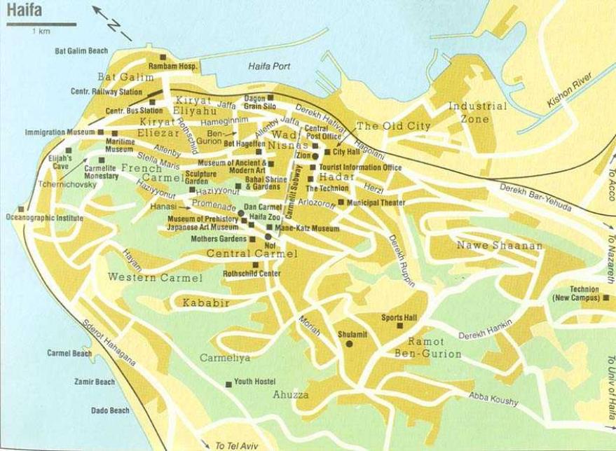
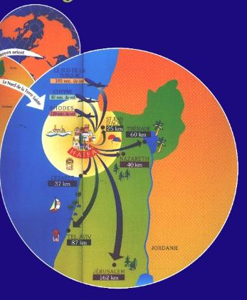
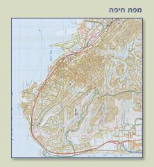
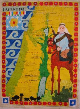
Haifa maps Cartes de Haifa
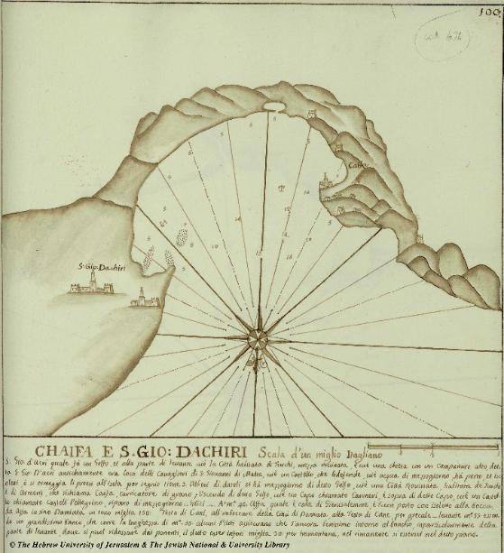
Probablement de Antonio Borg, probably by Antonio Borg
Piani diversi di tutte le isole... manuscript, plate 100 Date: 1760-s
Piani diversi di tutte le isole... manuscript, plate 100 Date: 1760-s
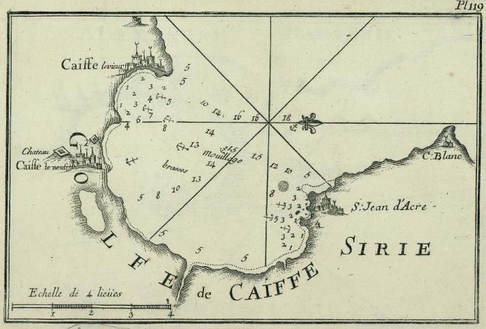
Joseph Roux
Recueil des principaux plans, des ports et rades de la Mer Mediterranie...
Plate 119 , Date: 1764 , Place: Marseille
Recueil des principaux plans, des ports et rades de la Mer Mediterranie...
Plate 119 , Date: 1764 , Place: Marseille

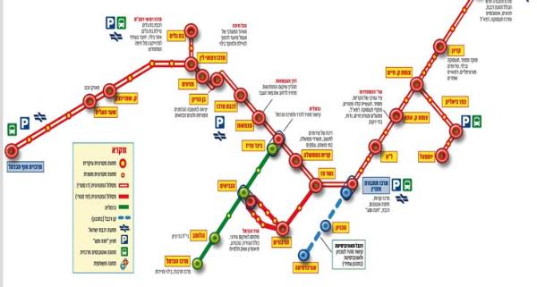
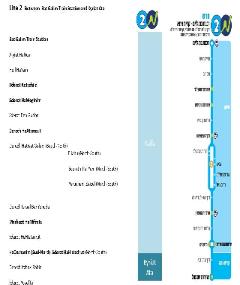
Ligne de la Carmelite (metro)
Carmelit subway
Carmelit subway

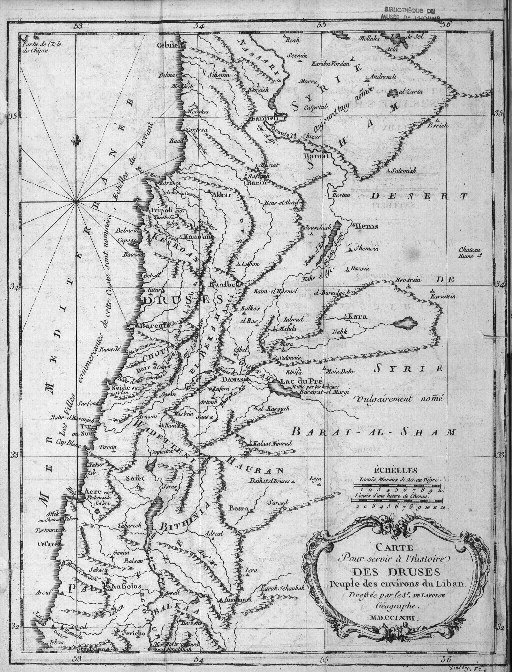
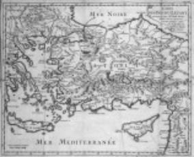
Croisey, 1763, carte pour servir a l'histoire des Druses
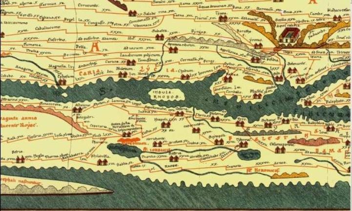
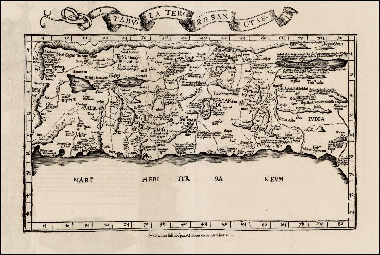
Peutinger, table
Seulement si vous venez de Rome! Cliquez pour le reste du chemin!
Only if you come from Rome! Click to see the complete way
Seulement si vous venez de Rome! Cliquez pour le reste du chemin!
Only if you come from Rome! Click to see the complete way
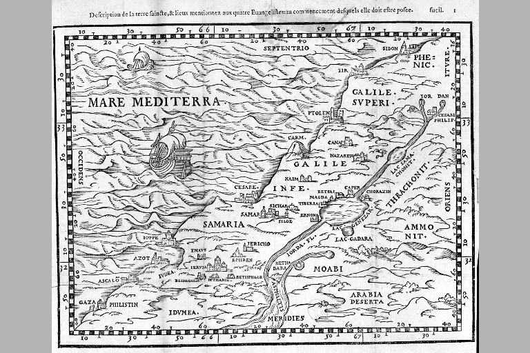
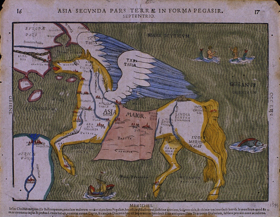
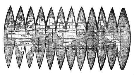
Description et Carte de la Terre
Paul Lucas
Joseph Gaitte, 1753
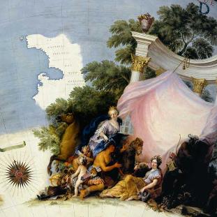
Haifa is situated in Asia, the beautiful woman on the right of the picture
Haifa est en Asie, representee par la dame elegante assise a la droite de l'illustration
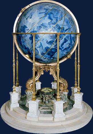
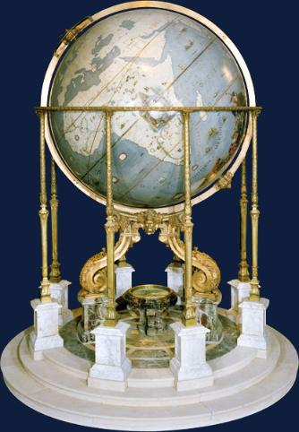
Globe terrestre et globe celeste de Louis XiV, Coronelli
Haifa est en Asie, representee par la dame elegante assise a la droite de l'illustration
Globe terrestre et globe celeste de Louis XiV, Coronelli
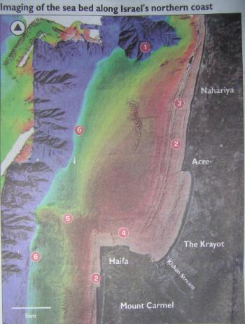
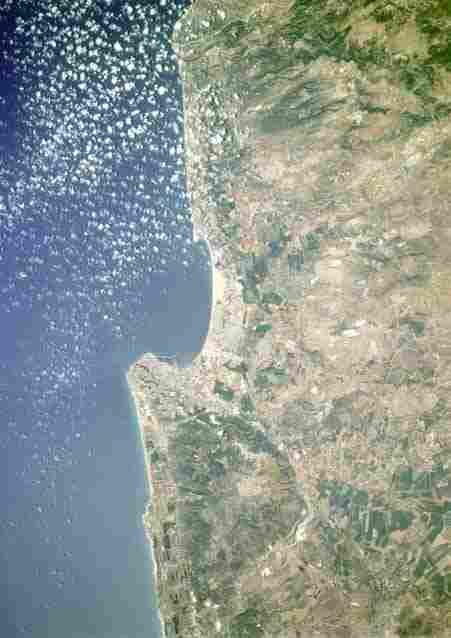
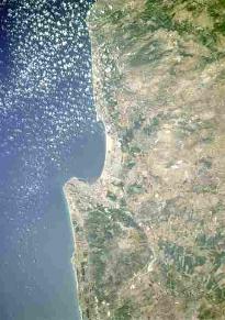
Plus moderne: Les fonds marins au large de Haifa, et Haifa vu de satellite
More modern: Sea bed imaging along Haifa and Haifa bay, satellite image
More modern: Sea bed imaging along Haifa and Haifa bay, satellite image
Sonar map reveals secret life of seabed Haaretz May31th 2007
By Zafrir Rinat
Israeli scientists have been studying the seabed along Israel's coast for many years. But they've been
groping in the dark, not entirely understanding its precise structure. Now, however, thanks to sonar
technology, that is changing. High-quality sonar scanning is being used to produce maps more detailed
than ever before. Practical applications include planning of ports and artificial islands, as well as
monitoring greenhouse gasses and delineating marine nature reserves.
The new mapping project has been moved ahead in recent years by researchers from Tel Aviv University,
the Israel Oceanographic and Limnological Research Institute (IOLR), and the Survey of Israel. The
project focuses on the continental shelf - the area of the seabed up to a few hundred meters from the
shoreline. One of its main results is detailed imaging of the northern seabed, from Haifa to Rosh Hanikra.
Arik Golan of the IOLR explains that the sonar system on the institute's research vessel was brought to
Israel from the U.S. by Israeli geologist John Hall, and had been developed originally for the U.S. Navy.
The mapping, which was led by Roni Sadeh of Tel Aviv University, was implemented by measuring 850
million reverberations from the seabed at depths ranging from eight to 900 meters, during voyages totaling
4,218 kilometers.
Surveys of the Tel Aviv beach area were also conducted, some of which examined the feasibility of
building artificial islands, and some for Golan's research into the effect of the seabed's emission of
methane, a gas that contributes to global warming.
Underwater wineries
Imaging of the Haifa Bay revealed the country's geological past. For the first time, the underwater
calcareous sandstone (kurkar) ridges can be seen. Sitting parallel to the beach, these ridges show the
location of coastlines dating back 10,000 years, when the level of the sea was lower. Calcareous sandstone
hills are now to be found up to a depth of 40 meters below sea level. These ridges bear the remains of
fishing villages from eras before the Neolithic period.
"Cisterns have been found at a depth of six to seven meters. They may have been wine vats," Golan says,
adding that he has also found underwater water cisterns off the Tel Aviv coast using the same methods.
Near Haifa, the continuation of the Carmel range can be seen on the sea floor. A huge canyon was found
off of Rosh Hanikra, created from past flows into the sea of the Kziv Stream. Sediment floating northward
from the Nile Delta over thousands of years covered part of the seabed, but did not manage to cover the
canyon. Between Haifa and Acre, the primordial stream beds of the Kishon and the Na'aman can also be
seen.
Geological rifts were also found in a few places. Golan says there is a debate among scholars about the
exact location to which the Carmel extended into the sea, and how active some of the documented rifts are.
"Without the information we are collecting now, projects like artificial islands could not be planned, nor
could the environmental impact be understood of port construction, such as the blockage of sand flow and
the future impact of changes in the level of the sea because of global warming," Golan says.
The imaging project will also allow biological data to be gathered, especially on the underwater ridges,
where a varied population of marine animal and plant life thrives. According to the director of the Science
Division of the Israel Nature and National Parks Protection Authority, Dr. Yehoshua Shkedi, the project is
like topographical mapping on land, allowing us to understand habitats and decide where marine nature
reserves should be established.


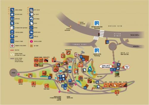
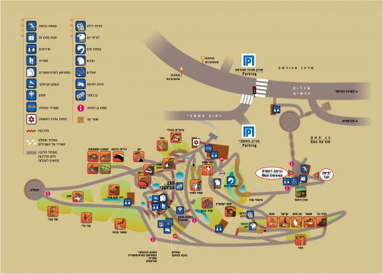
Les Dinosaures dans la ville (2008) et a Madatech
The dinosaures have left.
Les dinosaures sont partis
Meteore????
The dinosaures have left.
Les dinosaures sont partis
Meteore????
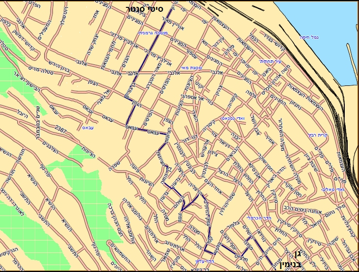
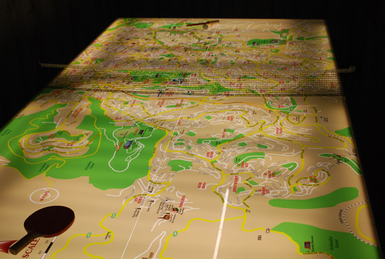
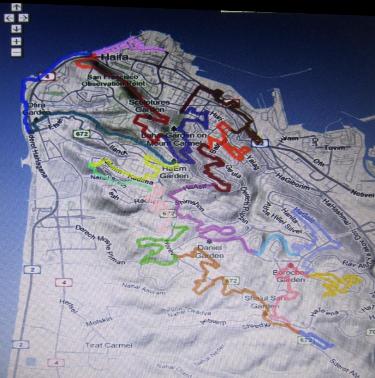
Cartes de randonnees a pied ou a velo dans les forets du Carmel
Map for bike rides and walks in the Carmel forests
Map for bike rides and walks in the Carmel forests
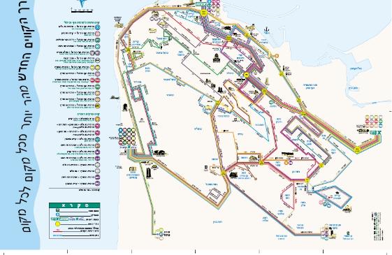
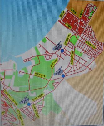
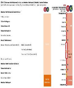
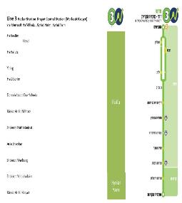
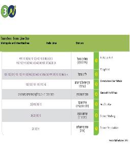
Lignes de la Metronite
Metronit light train BRT system
Metronit light train BRT system
Transports Transportation
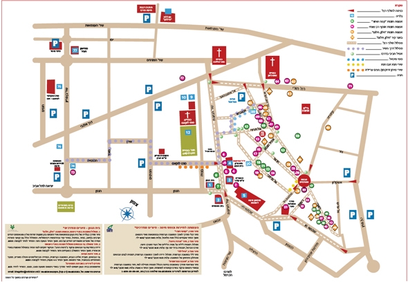
Histoire History
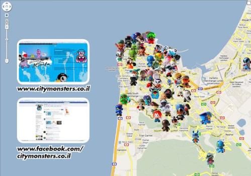
Du 11 septembre au 30 novembre 2009, des monstres emergent dans
la ville. Trouvez les sur la carte les lieux ou les rencontrer
From september 11 to november 30 2009, monsters appear in the city.
Find them on the map so that you can meet them
la ville. Trouvez les sur la carte les lieux ou les rencontrer
From september 11 to november 30 2009, monsters appear in the city.
Find them on the map so that you can meet them
Heindrich Bunting 1594
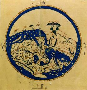
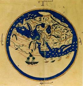
Al-Idrisi 1154
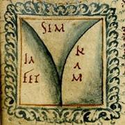
The world divided by Noah's sons
Le monde divise entre les trois fils de Noe
Le monde divise entre les trois fils de Noe
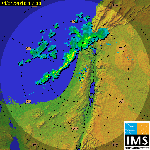
| L'orage approche! |
Ministere de la Construction,
Ministry of construction, survey of Israel
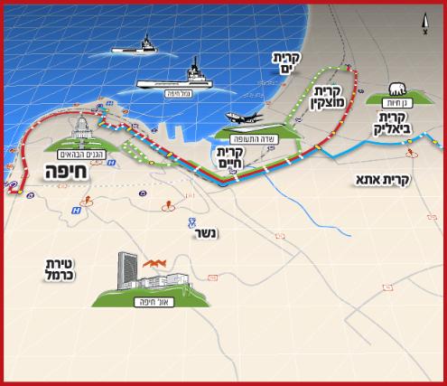
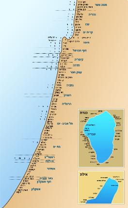
Cartes topographieques de Haifa, Acre,
Tiberiade, de Galilee,cartes marines etc...
Topographic maps of Haifa, Acco, Tiberias,
Galilee, marine maps, etc..
Ministry of construction, survey of Israel
Cartes topographieques de Haifa, Acre,
Tiberiade, de Galilee,cartes marines etc...
Topographic maps of Haifa, Acco, Tiberias,
Galilee, marine maps, etc..
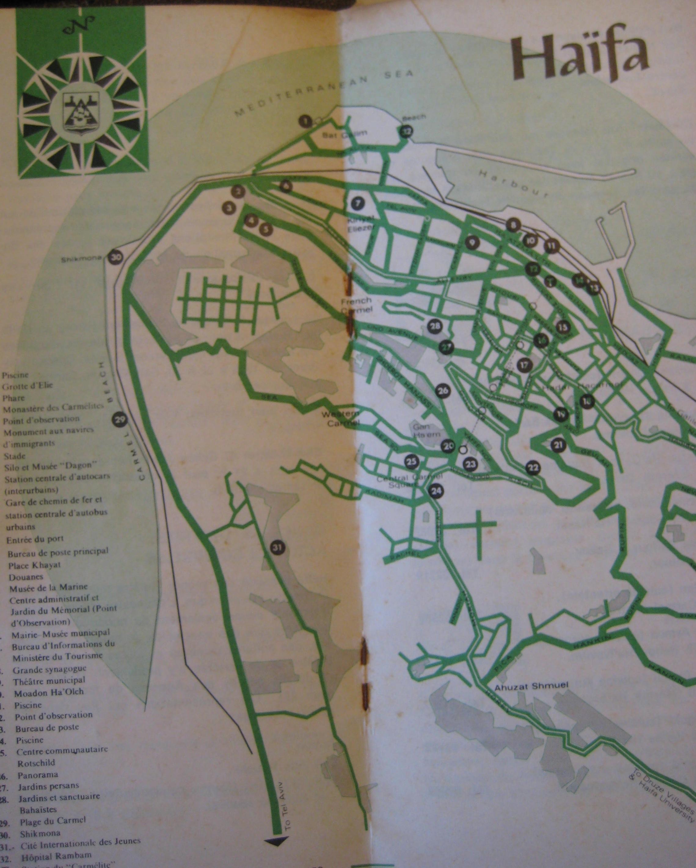
Haifa tourism office, 1970
Office du tourisme de Haifa 1970
Office du tourisme de Haifa 1970
Première Biennale Méditerranéenne d’Art Contemporain à Haïfa
First Mediterranean Bienniale of Contemporary Art in Haifa
First Mediterranean Bienniale of Contemporary Art in Haifa
Pyramida, galerie d'art dans les escaliers
Pyramida, art gallery in the stairs
Pyramida, art gallery in the stairs
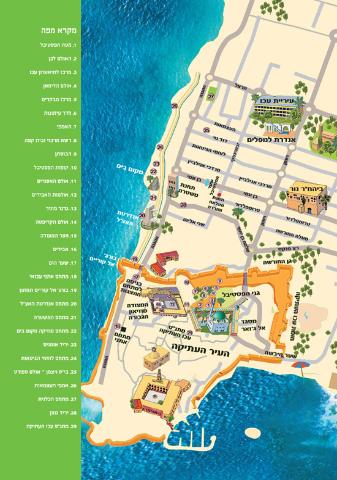
Jalons Landmarks
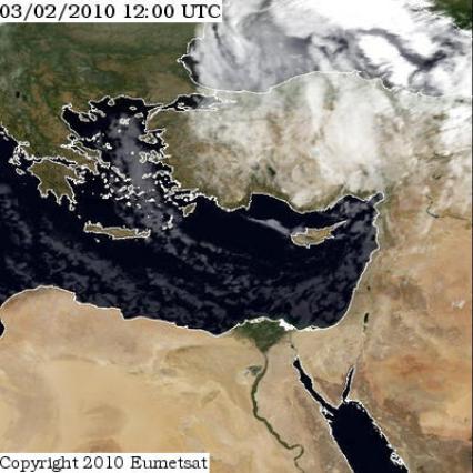
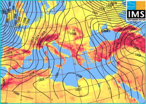
Meteo
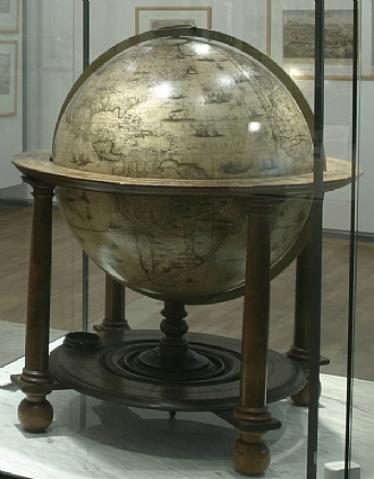
Globe, William Blaeu XVIIeme siecle,
Musee Maritime National, Haifa
Musee Maritime National, Haifa
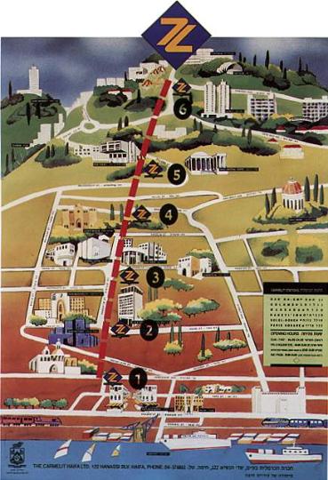
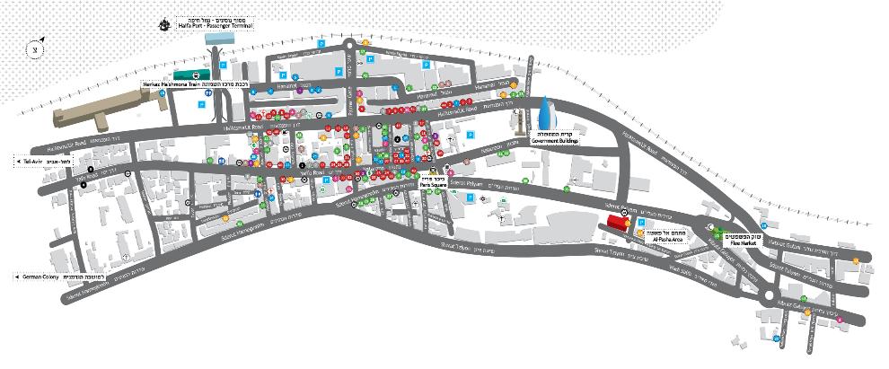
1 Kikar Paris Paris square
2 Solel Boneh
3 HaNeviim
4 Massada
5 Golomb
6 Merkaz Carmel Gan HaEm
2 Solel Boneh
3 HaNeviim
4 Massada
5 Golomb
6 Merkaz Carmel Gan HaEm
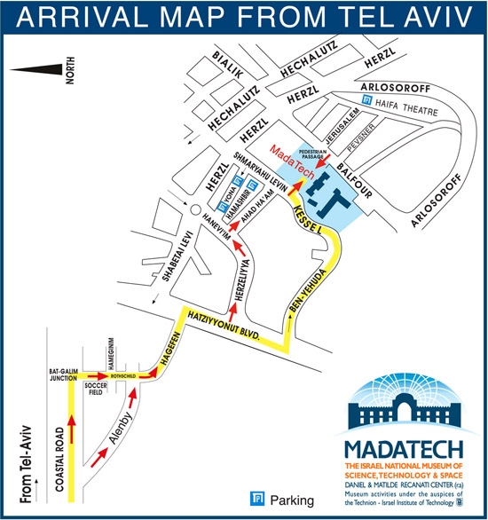
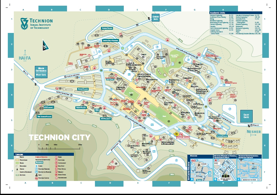
Technion Historic building
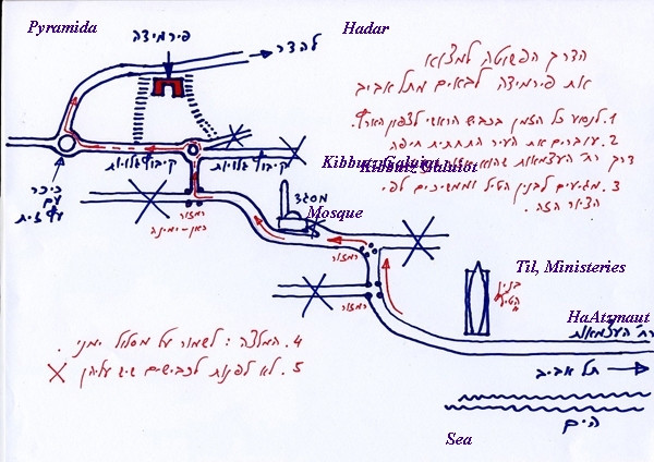
Hadar arrival from Tel Aviv
Batiment historique du Technion
Hadar, de Tel Aviv
Hadar arrival from Tel Aviv
Batiment historique du Technion
Hadar, de Tel Aviv
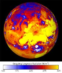
Longwave radiation (NASA picture)
radiation (grandes longueurs d'ondes)
radiation (grandes longueurs d'ondes)
Abed Abdi
Alexandrie, Gaza, Ashkelon, Ashdod, Tel-Aviv, Natanya, Hadera, Haifa, Beyrouth
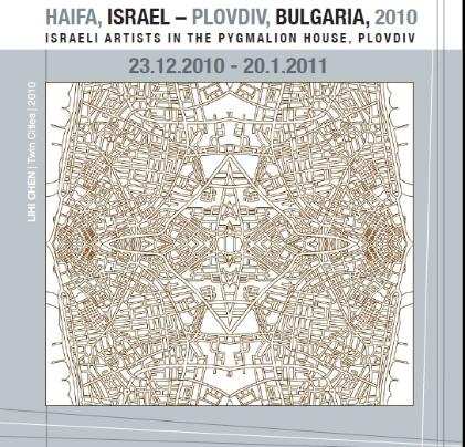
Lihi Chen Haifa-Plovdid, villes jumelles
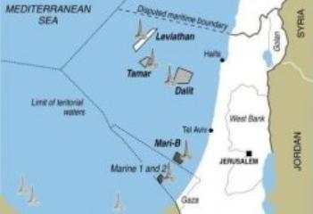
Gisements de gaz naturel au large de Haifa
Natural gas offshore Haifa
Natural gas offshore Haifa
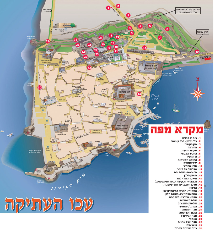
Saint Jean d'Acre
Akko, Acco
Akko, Acco
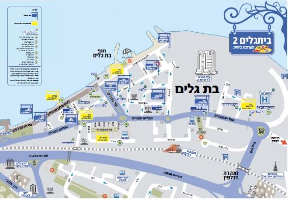
BeitGalim Festival
Portes ouvertes, les Artistes de Bat Galim
Bat Galim artists open their doors
Portes ouvertes, les Artistes de Bat Galim
Bat Galim artists open their doors
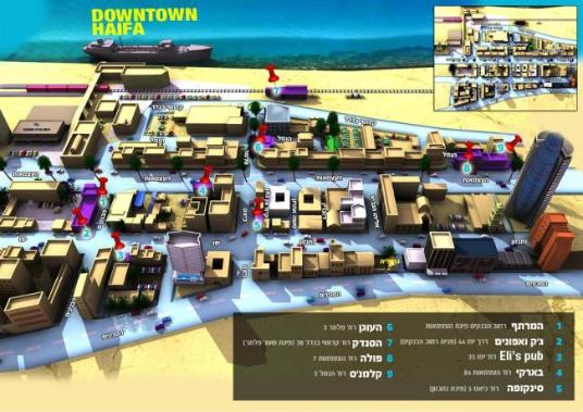
| 1 HaMartef 2 Jack VeHaAfuna 3 Eli's 4 Barki 5 Syncopa |
| 6 HaOgen 7 HaSandak 8 Paula 9Kalman's |
Pubs au Campus HaNamal
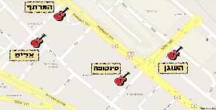
Haifolk music festival venues
Eric Bokobza
HaShomer
Haggada
HaShomer
Haggada
Carte de Lorens Fries, Strasbourg, 1535
Waldseemller
Projection of globe
Projection of globe
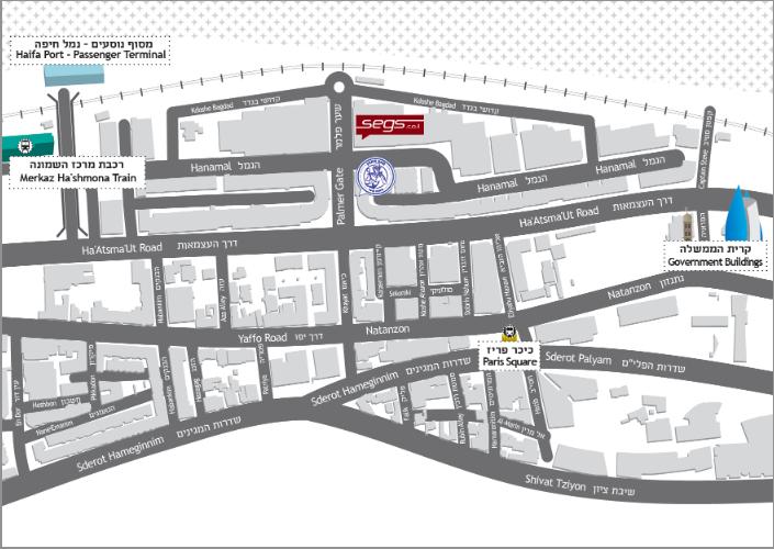
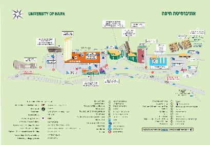
Access to Haifa University and to the Hecht Museum
Acces a l'Unicersite de Haifa et au Musee Hecht
Acces a l'Unicersite de Haifa et au Musee Hecht

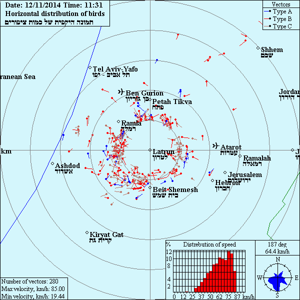
Migrations d'oiseaux
Migration of birds
Migration of birds
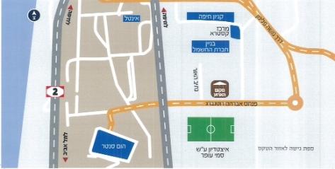
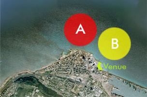
Stade Sammy Ofer
Sammy Ofer stadium
Sammy Ofer stadium
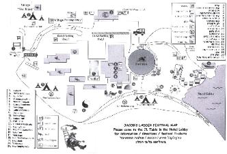
Jacob's ladder folk song festival
Kibboutz Ginossar
Kibboutz Ginossar
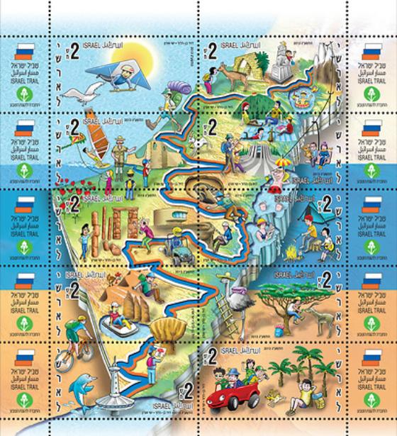

Shvil Israel Israel path, stamp
Shvil Israel Le chemin d'Israel, timbre
Shvil Israel Le chemin d'Israel, timbre
Festival Sunbeat,
Maayan Harod
Maayan Harod

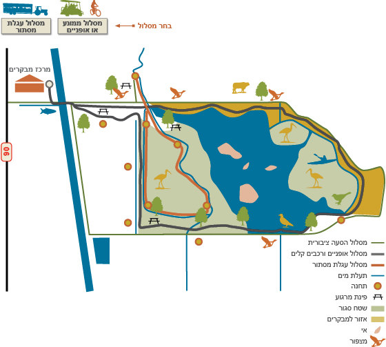
Reserve naturelle du Hula
Hura natural reserve
Hura natural reserve
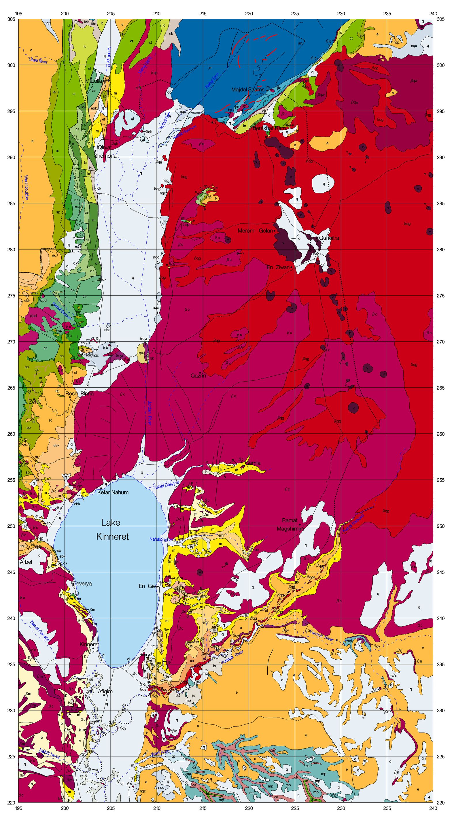
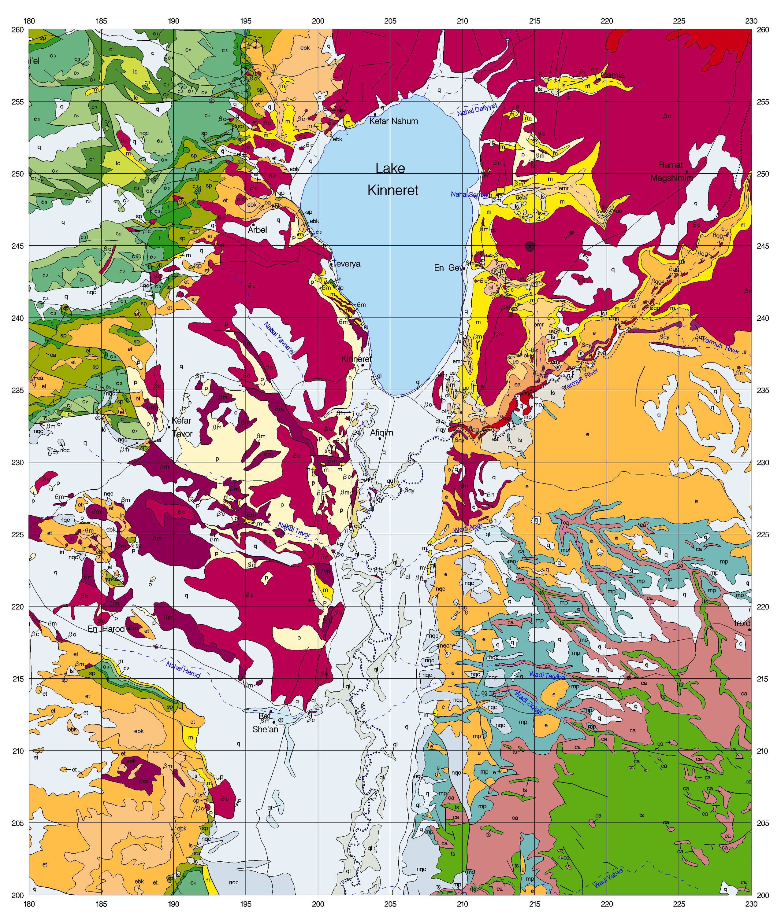
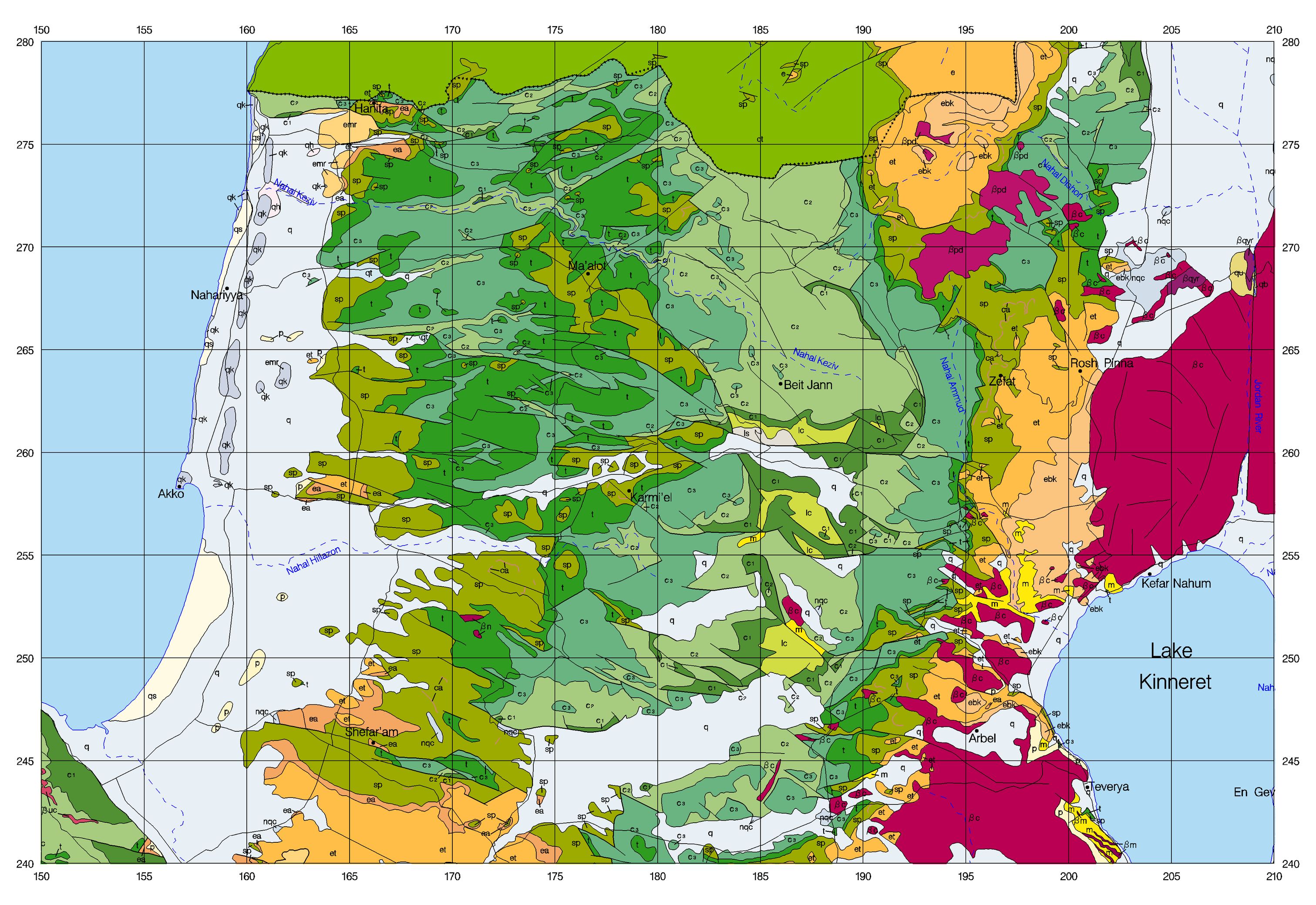
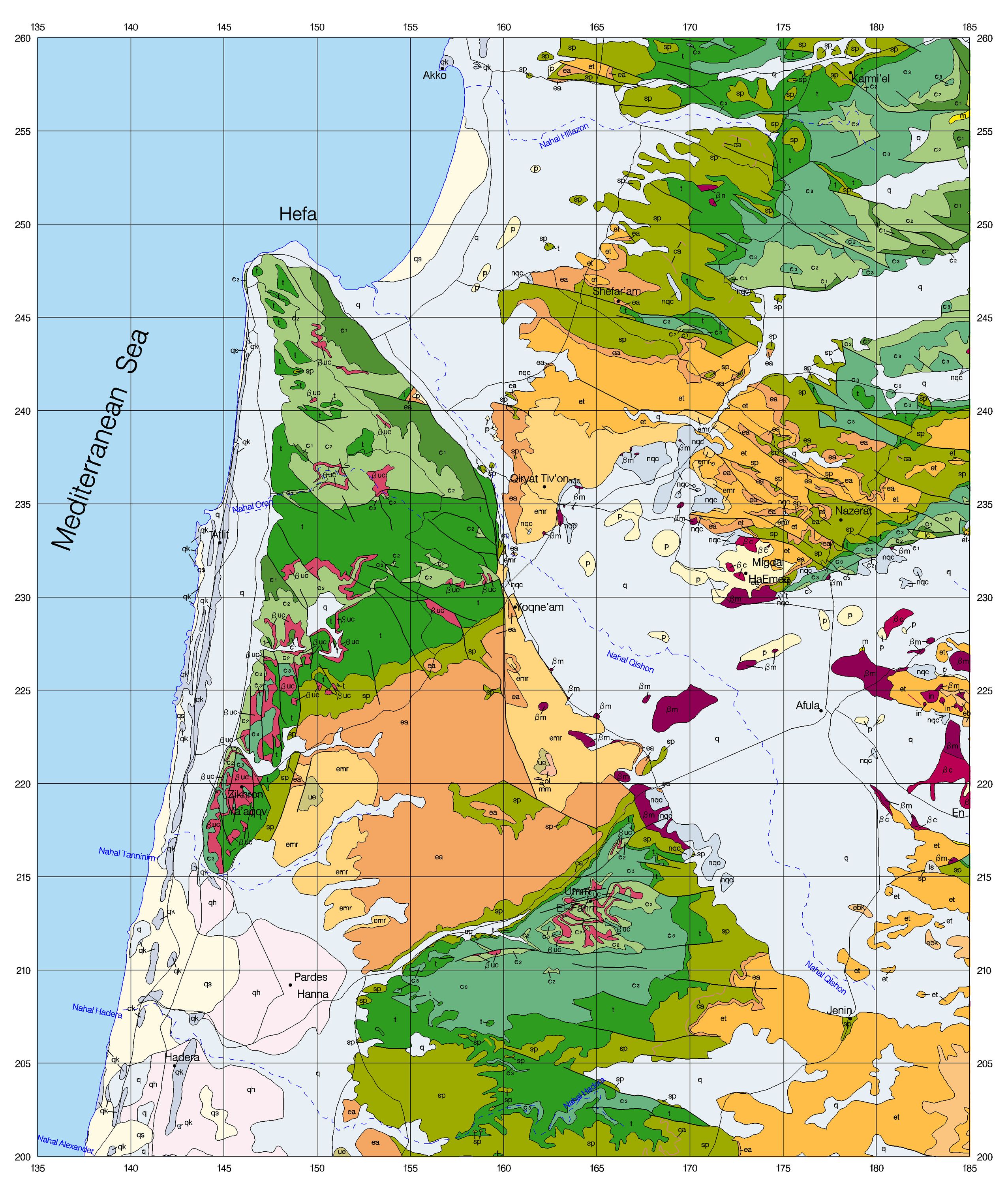
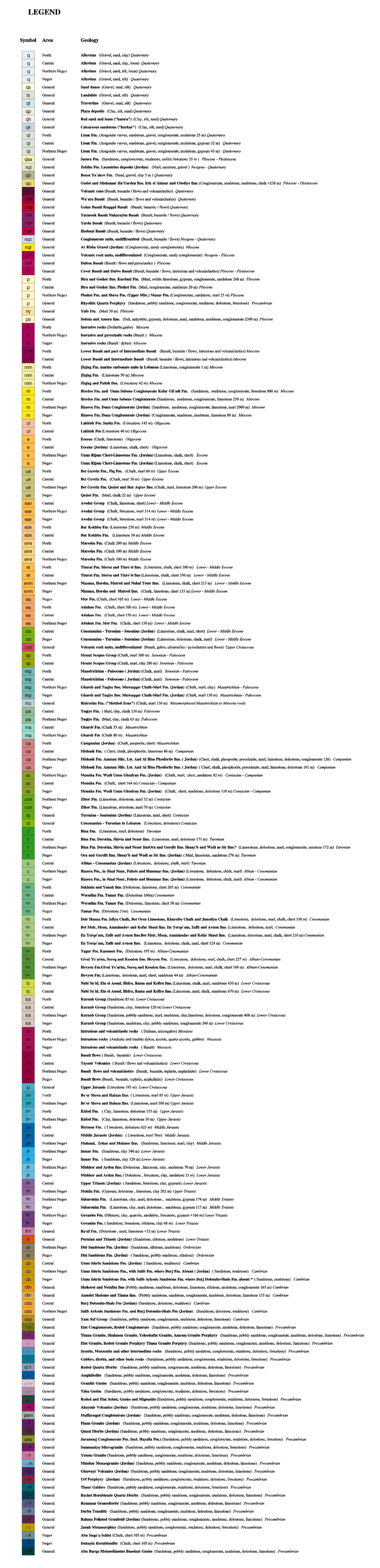
Carmel, Kineret, Golan, Galilee,
Cartes Geologiques cliquez sur la legende ou sur la carte pour agrandir
Geological Survey of Israel click on the legend or on the map to enlarge
Cartes Geologiques cliquez sur la legende ou sur la carte pour agrandir
Geological Survey of Israel click on the legend or on the map to enlarge
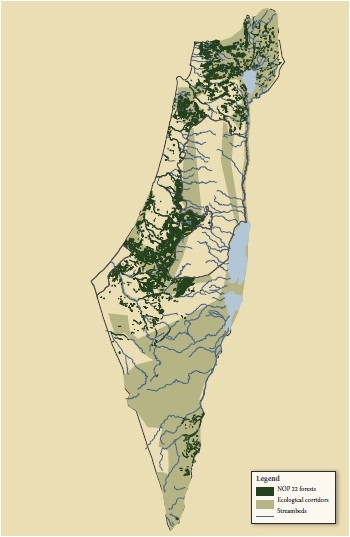
Forets et ccouloirs ecologiques
Forests and ecological corridors
from Tama 22
Forests and ecological corridors
from Tama 22
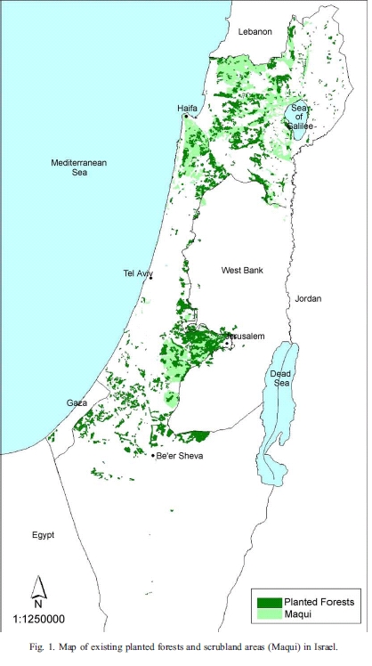
Forests and maquis
from Amir and Reichtman
from Amir and Reichtman
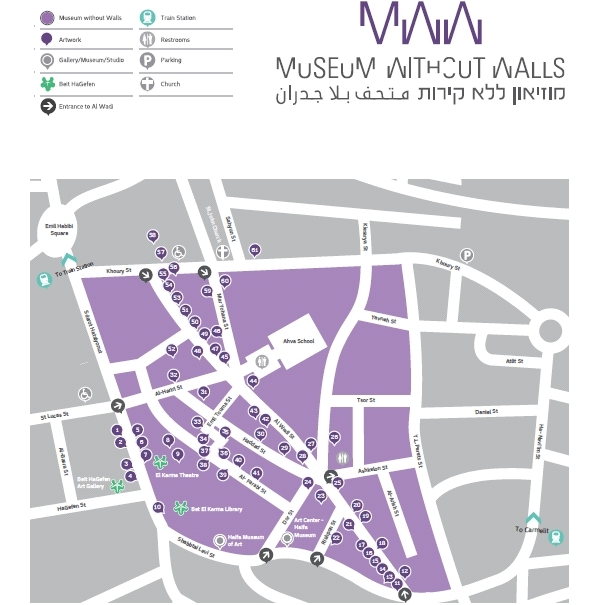
Wadi Nisnas
Musee sans murs
Museum without walls
Musee sans murs
Museum without walls
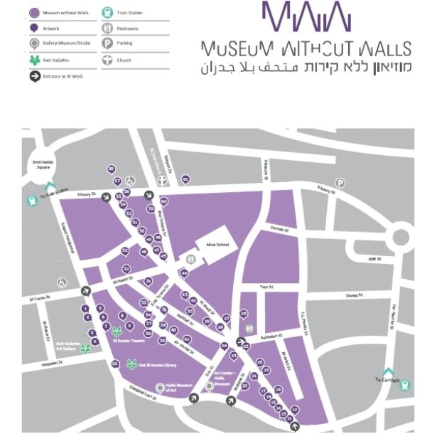
Emplacement des oeuvres d'art: fresques, statues, installations, ceramiques
Place of art works, frescoes, ceramics, installations, sculptures
Place of art works, frescoes, ceramics, installations, sculptures
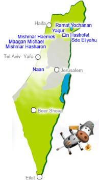
Ulpan Kibbutz
Oulpan Kibboutz
Oulpan Kibboutz
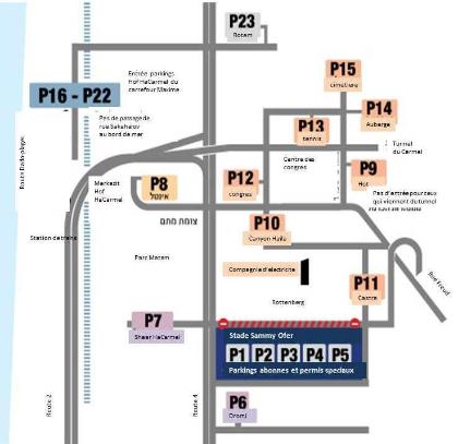
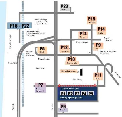
Stade Sammy Ofer Parkings
Sammy Ofer Stadium Parkings
Sammy Ofer Stadium Parkings
Venant de Haifa –rue Freud et tunnels
Coming from Haifa -Freud and tunnels
Venant du Nord
Coming from North
Venant du Sud route 2
Coming from South route 2
Venant du Sud route 4
Coming from South route 4
Coming from Haifa -Freud and tunnels
Venant du Nord
Coming from North
Venant du Sud route 2
Coming from South route 2
Venant du Sud route 4
Coming from South route 4
Keywords Haifa, carte, map, e-map, historical, historique, satellite, Metronit, Carmelit, Carmelite, Metronite
Harper-Collins / Collins Bartholomew 2014
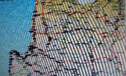
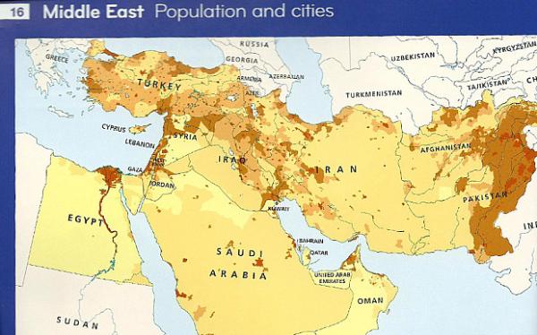
map of the Middle East
map of the Middle East


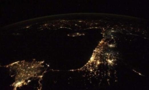
La voie lactee, Milky way
Galilee, Haifa NASA